Home › Forums › Historical Tabletop Game Discussions › North Africa Photos
Tagged: Bolt Action, Desert, Flames of War, North Africa, Terrain SPAM
This topic contains 13 replies, has 9 voices, and was last updated by ![]() wolfie65 1 year, 10 months ago.
wolfie65 1 year, 10 months ago.
-
AuthorPosts
-
August 25, 2018 at 10:39 am #1257238
I did a battle field tour covering the war in North Africa from Tripoli to Cario back in 2007.
Here a some photos that show some of the terrain in the area.
Hope the photos inspire some tables for the upcoming boot camp.
Brendan
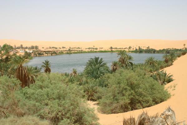
An oasis deep in the Libyan desert.
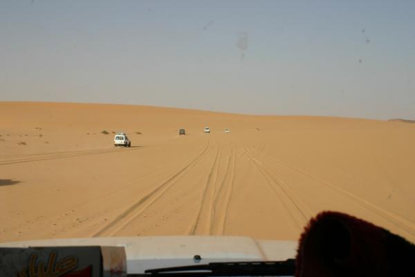
“On Patrol” driving through the Libyan desert.
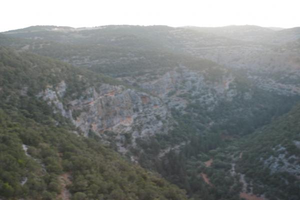
Heading up to the mountains north east of Benhgazi . Shows the flat costal plain.
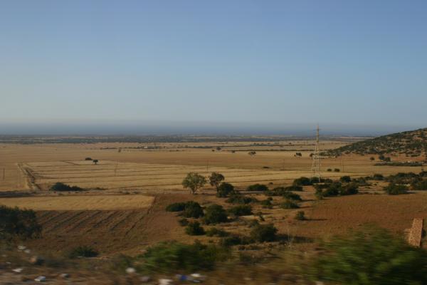
Mountains north east of Benhagzi. This is not the sort of terrain I think of when I think of he desert war.
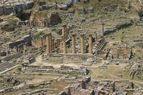
Ruins of Cyrene. Warren mention fighting in ruins of some old temple. (Is that a Star Gate hiding in the background)
 August 25, 2018 at 10:48 am #1257240
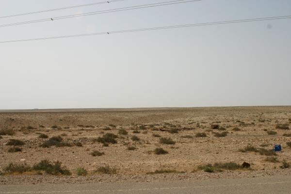
The following show various views around Tobruk.
The terrain can appear flat, but there a plenty of gullies to hide in.
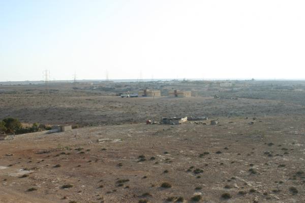
Remains of various fortifications.
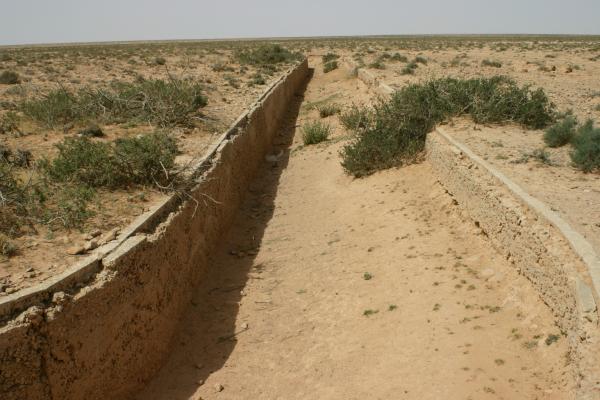
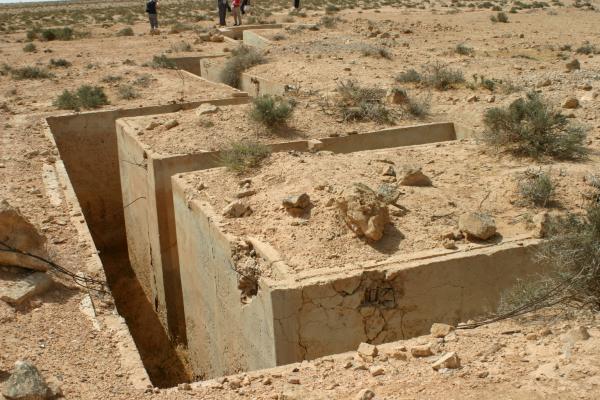
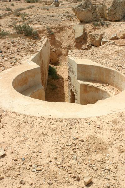
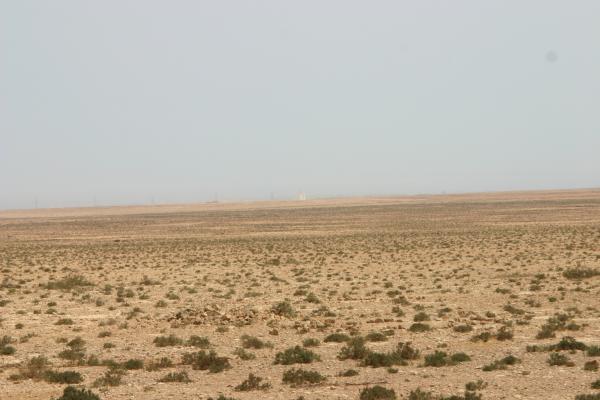
Tobruk Harbour
 August 25, 2018 at 10:52 am #1257251
Very cool, really brings the battle fields to life. Those ruins or the oasis are perfect for an in infantry skirmish.
Thanks for sharing
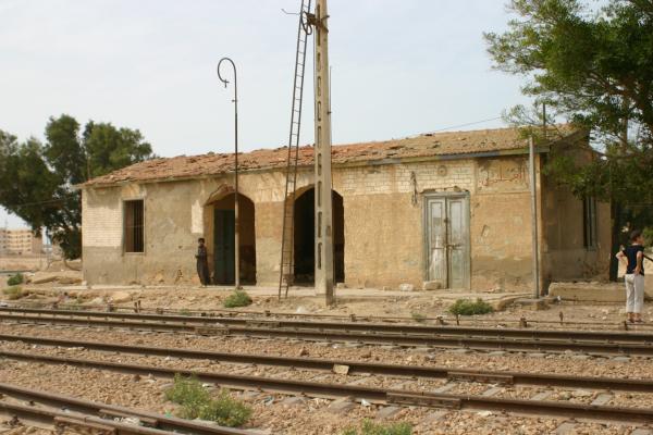
August 25, 2018 at 10:53 am #1257252El Alamein station
 August 25, 2018 at 11:00 am #1257254
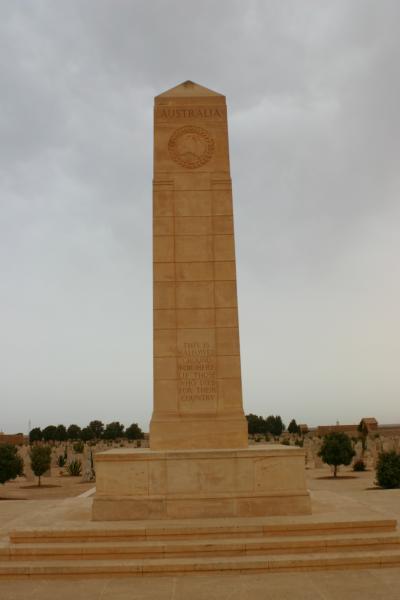
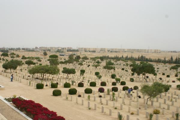
Remember to spare a moment to remember those who fought.
Australian Memorial at Tobruk
El-Alamein Cemetry
German Cemetery at Tobruk
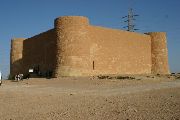
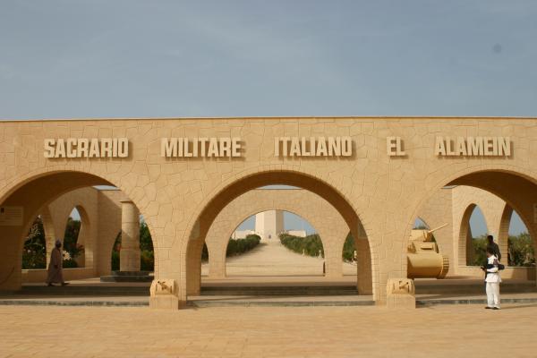
Italian Memorial at El-Alamein
 August 25, 2018 at 11:06 am #1257255
Wonderful pictures! Thanks for sharing buddy ?
An oasis table is clearly a must!!!
The trench board the guys are building came as a surprise but for a Tobruk scenario absolutely appropriate.
I wonder if the surprisingly green appearance is a seasonal feature or is it always like this?
August 26, 2018 at 6:38 am #1257582Great photos, @thunderchildobs !
I’ve never traveled these battlefields myself but in accounts and old photos you really do see a lot of green in certain places, along the Cyrenaican plateau (such as in “Northeast of Benghazi” photos thunderchildobs posts). And of course Tunisia, which in a lot of the fighting was barely a “desert” at all.
For some reason, it seems the higher the elevation, the greener the landscape. The really “desert” spots you see tend to be the lower areas, with the Qattara Depression being a borderline moonscape.
Kind of a generalization, and again, just going off old photos I’ve seen. I’m sure @thunderchildobs would know better. 😀
Those are exactly the kind of Roman / Ptolemaic ruins I was suggesting the guys build if they really want to do some ruins.
What I like most about your photos is how they show how absolutely FLAT a lot of that terrain is. Of course, hull down shielding is still possible using rises and folds in the ground barely perceptible from these vantage points, as we discuss in the Weekender episode. But these can be honestly challenging to recreate on the tabletop in proper proportion and scale.
And lastly, fortifications were all over the place in the desert. The Italians had fortifications along the Egyptian-Libyan frontier, there’s the Mareth line in Tunisia, the British “brigade boxes” at Gazala, then Mersa Metruh, and finally along the Alamein line, and of course Tobruk. German and especially Italian field works also became very elaborate during the buildup to Second Alamein.
August 26, 2018 at 6:31 pm #1257895I wonder how many “fortifications” outside of long sieges like Tobruk were “bulldozed” fortifications (rather than digging a hole in the ground). As we saw in more recent conflicts (7 Day war onwards) in areas where the terrain is mainly “sand”, the military seem to build up berms etc (rather than digging elaborate trench networks). I’m sure the staple 2 man slit trench was rule of the day for infantry units, but I’ve not seen many photos of trench networks in N.Africa during WWII (other than the concrete bunker fortifications), certainly not in the manner of WWI networks (with multiple lines of trenches).
I’m not say there weren’t, but I’ve yet to see many photos (tho I suppose unless it’s concrete, if the troops aren’t there to maintain them I guess they get lost to “the sands of time” pretty quickly 🙂
August 26, 2018 at 11:29 pm #1258081Great photos and a brilliant reference source. Many thanks for starting this thread.
August 27, 2018 at 5:56 am #1258169Great question, @phaidknott – This is sort of what we were touching on over on the trench board VLOG thread. How strictly ‘WW1 angular’ the trench system should or shouldn’t be, given the relative haste with which most WW2 field fortification works were put in place.
Also, I found at least in France, that except for a few memorials, etc … people are pretty keen on bulldozing these fortifications out of the way immediately after the war. Can’t blame them, they’re ugly, they remind people of a nasty time, and their specifically design to impede travel. Also, US and British armies bulldozed of blew up most of them to clear the routes off the invasion beaches. So again, very few of them survived.
August 28, 2018 at 10:22 pm #1259291Thanks for posting these @chunderchildobs – it’s possible weird of me to say this, but I find this terrain so beautiful. Partly because it’s more varied than most people tend to think – at least if you can travel some distance.
March 2, 2023 at 10:12 pm #1805121March 3, 2023 at 12:37 am #1805122 -
AuthorPosts
You must be logged in to reply to this topic.














![TerrainFest 2024! Build Terrain With OnTableTop & Win A £300 Prize [Extended!]](https://images.beastsofwar.com/2024/10/TerrainFEST-2024-Social-Media-Post-Square-225-127.jpg)
