Crazy How Nature Do That…
Recommendations: 44
About the Project
Everyone need scenery, right? Boards look bloody empty if we don't bother with it... But what about accuracy? What would things look like in the real world? We can't look out of our windows and see all possible scenery there is in the world, so I am adding what I can from my current location and other places that I come across in my travels...which should be much farther afield once I can get into some Geology fieldwork... Hopefully others can add their own projects to help build up a big enough reference section for a wide range of terrains. For each entry, I will try to describe areas of the world where this type of scenery would exist and also certain historical conflicts that it may pertain to. Hopefully this is useful to those trying to build some nice boards, but if not then the scenery should be nice to look at...hopefully...
Related Genre: General
This Project is Active
The Red Planet.
Been a while since I uploaded to this project, but with the recent landing of Perseverance on Mars I thought this was a good a time as any to post something new. It’s not like any of us can pop over to Mars to have a look, but I’ve actually done some academic work related to Mars and have been around people who have studied our sister planet quite in-depth, so I thought I’d share some things that might help people come up with some nice sci-fi settings.
 The Red Planet...that is actually sort of brown-ish. The massive scar you can see here is an ancient canyon called Valles Marineris that shows signs of once carrying water across the surface.
That’s right, Mars once had water! Technically it still does, but it’s buried ice, mainly. Seems a bit weird to have buried ice, but Mars actually has a much thinner atmosphere than Earth, so so any ice exposed on the surface sublimates to water vapour. Basically it goes from solid to gas without passing through the liquid stage. It’s all because of pressure, but that thinner atmosphere does something else important for anyone trying to ‘imitate’ the surface of Mars.
I said Valles Marineris is an ancient structure, and it is. On Earth when you find these sorts of things they have been eroded away by wind or water and they are almost shadows in the ground. On Mars, erosion takes a lot longer. Thin atmosphere means weak winds. Weak wind can’t erode things and tend to carry smaller particles. So remember that on worlds like Mars those tiny red dust fragments are likely to get EVERYWHERE! Makes you wonder how the Adeptus Mechanicus keep all those toasters running…
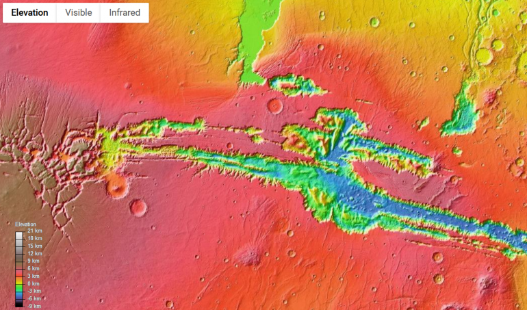 Just to show you how little has eroded from an elevation map of the Valles Marineris with red being 3km above 'sea level; and blue being 3km below.
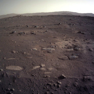
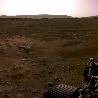
This means that the pictures we get from Mars are something we know has been there for a while, if we ignore the dust. This is pretty handy for terrain building because it means that structures won’t erode too quickly and a ‘settlement’ of several hundred years ago would still sort of look alright albeit covered in dust and probably not have any moving parts free to do so anymore. So pictures like below pretty much cover all we need for a general surface. Rememeber though that I said things don’t erode very quickly, this goes for water patterns too! On Earth we sometimes find old water beds with all the little dunes like are on the beach, but we only find these ancient river beds in good nick if they were covered quickly and saved from erosion. On place like Mars they may survive for much longer! Important thought if you’re planning a Mars-like planet!
From a geology point of view, being able to look at things like this is great as it shows us how things can happen on Earth thanks to science not really giving a damn which planet you’re on. The Laws of Physics work if you’re on Earth, Mars, Pluto, or anywhere else. This also doesn’t even begin to cover the volcanoes on Mars! Olympus Mons is the largest Shield Volcano (think Hawaii) in the Solar System, for example! But for all our volcano reference material there’s plenty we can see on our own planet. Maybe one day I can get nice and close to one and do a post for volcanoes!
So a really useful take away from this is dust. You want to do Mars? You need dust. Everywhere. Even in the toaster. It’s the reason most rovers have a lifespan; they can only run on solar if the panels don’t get covered in dust! Also remember that your tables for a ‘Martian’ style planet shouldn’t be flat. It’s not a moonscape of craters (though Mars does have a massive crater in it), it’s a dusty, rock landscape with no more water left on the surface. And if anyone is interested in it, Astrogeology is a fascinating subject to read about! Venus is particularly interesting, but I won’t go into that here!
I promise once I can get out and about again the next posts will be something on Earth. Maybe the Canadian Shield? We’ll have to see.
Fjorden av Norge
Norway is famous for its fjords and they stretch along the whole shoreline of the country. The specific fjord that I’m going to talk about here is Nærøyfjorden that runs from Myrdal at the start until it meets up with Sognefjorden. Iæm going to focus on several features of fjords that are off to the side (literally in some senses) of general knowledge. These photos are a few years old (I haven’t been to Norway in 4 or 5 years, now) but they should get the message across.
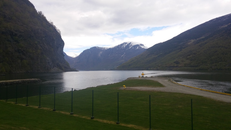 This is from the dock at Flåm and is pretty much at the starting point of the fjord, proper. The shape of the valley here is typical of the U-shaped valleys that almost define a glacial valley. Over time, erosion does smooth out the slopes, but they are generally very steep.
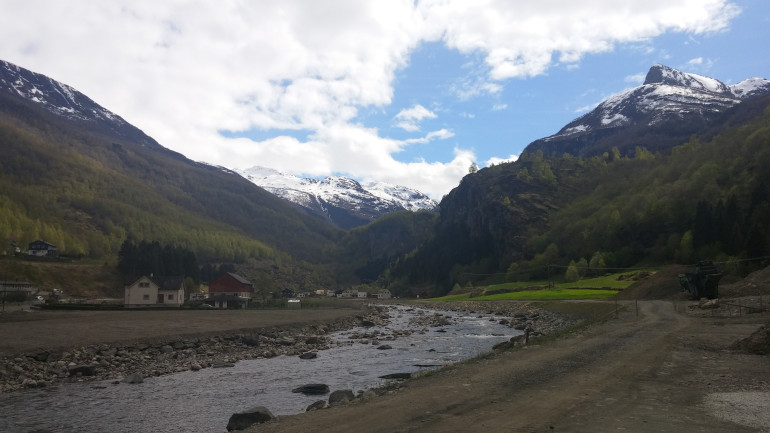 The flipside to that is the dal, or valley, behind the water. The amount of this valley that is submerged does vary with changing sea levels, but will typically have a waterway running down it's centre into the fjord. Typically, this is going to be the focus for us gamers and are places where a lot of Norwegian towns and villages are located, alongside many of the larger cities like Oslo.
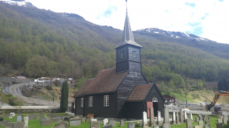 This is the church at Flåm that has been there since the 1600's. It's not a Stave church of earlier designs (I sadly never got the chance to see on of them on my journeys) but it is still the local church.
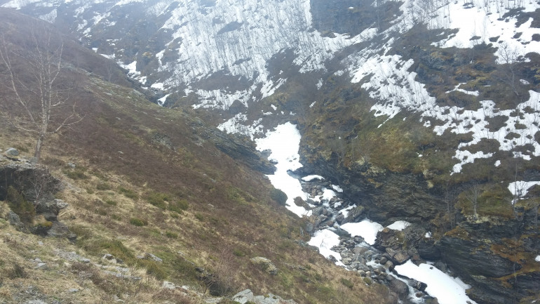 This is from way up the top of the cliffsides and shows the carved channels that are formed by water from the spring thaws trying to reach the sea. These are common throughout a fjord, but this type of landform will be generally at a higher altitude, or form deep cuts into gentler slopes.
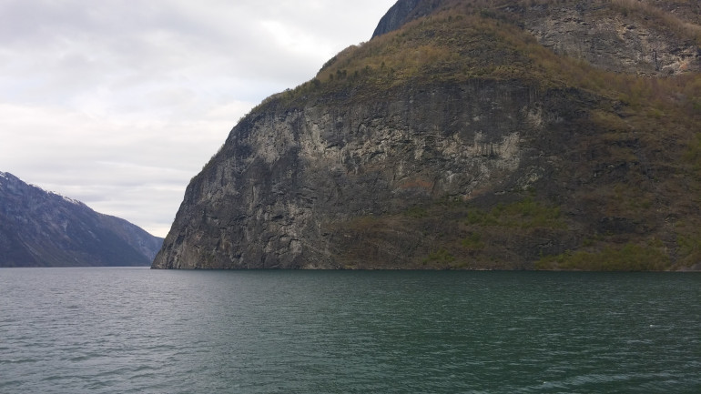 With all of the exposed rock going back millions of years, you often find stratigraphic formations dotted throughout a fjord's walls.
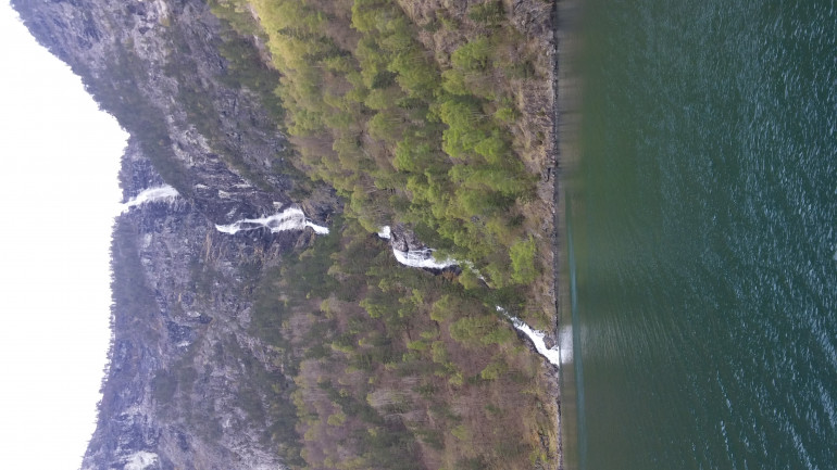 Annoying, this one loads sideways... But I can't just pop back and retake the picture in landscape now... This shows the ways in which the water will flow to the fjord. Where the water cuts to a solid cliff and then free falls to a lower level, we call that a hanging valley and most streams in young glacial valleys will start this way before eroding a cut down to a continual flow.
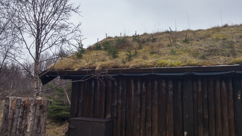 Jumping further north to Lofoten, there's a few extra things related to building that I wanted to touch on. This is something that is still quite common in rural areas of Norway, from what I saw, and that is soil on rooves. It's a very simple form of insulation that has been used for centuaries and may be useful for people wanting to build older buildings for their historical games.
 This will be slightly distorted due to the panoramic shot, but this is the Viking Museum at Borg on Vestvårgøyen, Lofoten. It's actually built upon the archaelogical ruins of the site that was built there in the Viking age and if anyone has a chance to go it's a great place.
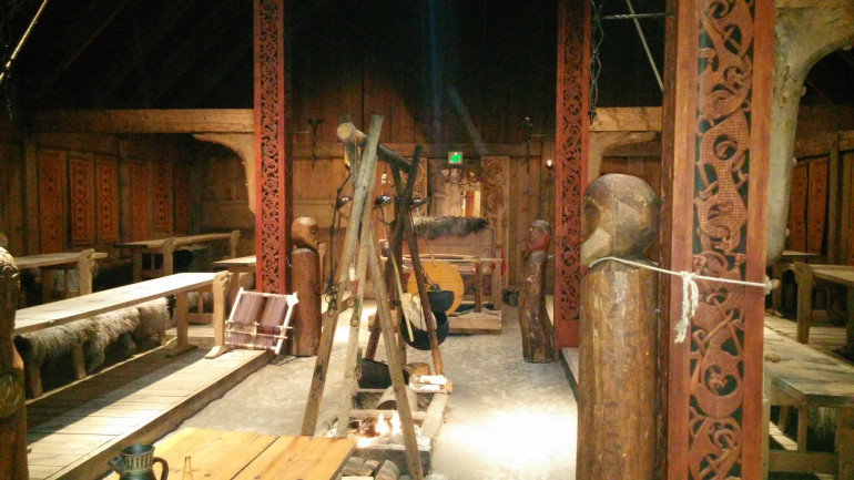 The interior of the feating hall is a great way to show archtechture for anyone brave enough to try and build the inside of a longhouse for games. I applaud you if you try, but I refuse to follow your lead...
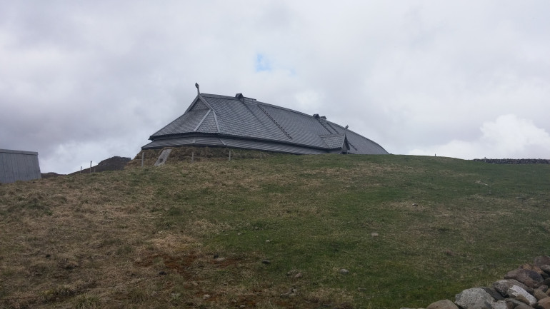 And then a less distored picture of one side of the longhouse I took as I was leaving...purely because there was a raven-like bird sitting on it...but he'd buggered off by the time I got the camera out...
Obviously, these references are a little more specific to a certain area, but will be useful for viking settlement boards but also the few building shots may work for viking settlements in the UK and Ireland along side the other Scandinavian countries, though regional differences will occur. They would also be of interest for anyone wanting to do Norwegian resistance for WW2, though much of the major fights there would have been over less rural and more ‘targets of military value. Hopefully it helps someone, though!
Med vennlig hilsen!
Carolinian Forests of Eastern North America
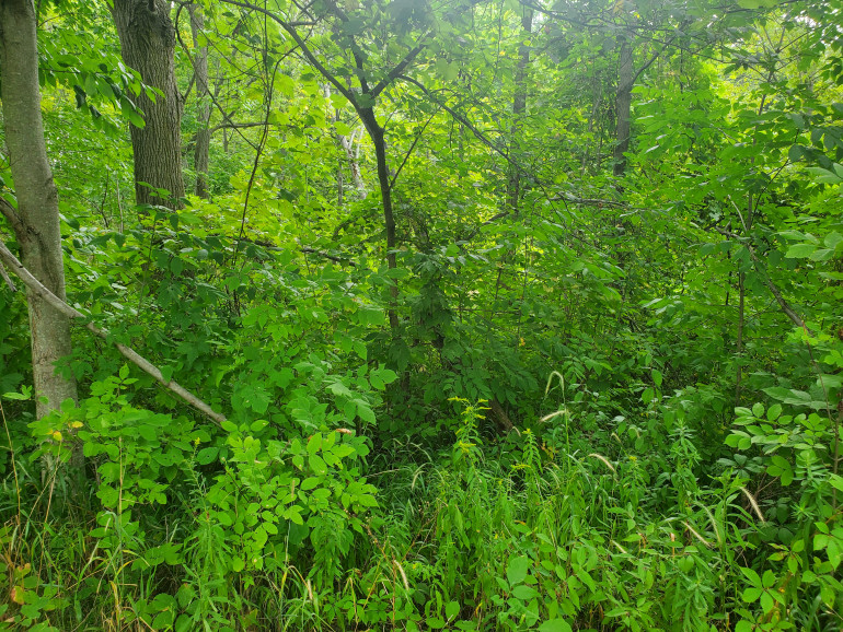
While some of these pictures do have a few evergreen trees, like pines, dotted around, a Carolinian Forest is primarily deciduous trees that grow quite in quite densely packed groups as a lot of these pictures show. It should be noted that if you do google this term, you may also come across the term ‘Eastern deciduous forest’, it’s basically just one is American and one is Canadian, but the forests are very similar with, obviously, less deciduous trees as you go north…
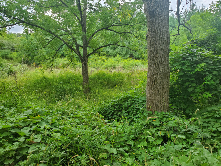 Very thick undergrowth is very common, some of this came up past my knees; and I'm a lanky almost 2m (6'5.5" in old money) tall!
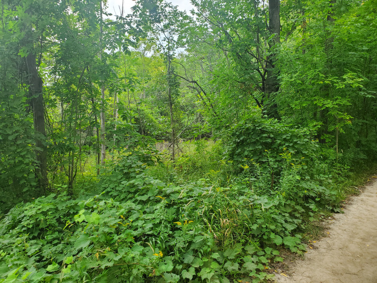 Very difficult to move through, if off the path. Something far better suited to skirmishers and is a major reason for many local Native tribes fighting how they did.
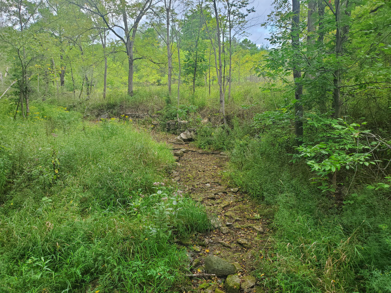 While it has been VERY warm this year, the summers in this area do tend to be a bit on the warm side, so dried stream beds such as this will be common in summer, but will be quite vigorous during the spring thaws.
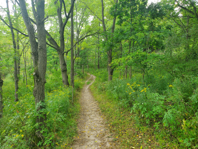 Simple tracks like this would be likely where travellers would move through. While these paths would have been initially man made when the parks and trails were set up, over time these are primarily maintained by people walking over them, as would have happened in the past. It should be noted, though, that these tracks would be suitable for a regiment to march along at no more than 4 men wide...very vulnerable to ambushes.
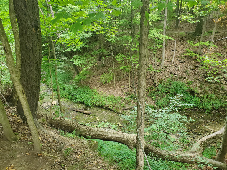 Particularly in many of the previously glaciated areas, gullys and gorges like this one are common. Many local terrains around here show various signs of glaciation and the walls of these sudden drops really are quite severe; a European style regiment stuck in an ambush at the base would find it very difficult to fight their way up the sides.
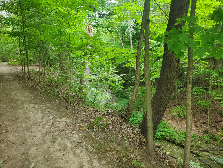 You can see from the trees there that the stability of the sides of the gorges isn't great, but when coming up with terrain like this, that litte bend at the base of a tree along the edge really knocks the realism of the piece up a tad. Remeber, though, older trees have experienced the soil creep for longer and bend a bit more!
As I said, this terrain is endemic to large regions of Eastern North America and may be familiar to those who have seen films like The Last of the Mohicans. This sort of terrain is perfect for the French and Indian Wars, The American Revolution, The War of 1812, possibly some small skirmishes during The American Civil War, and also pre- or early European Native conflicts such as the war between the French backed Wyandot (or Huron) and the British backed Haudenosaunee (or Iroquois Confederacy). This sort of terrain does favour skirmish combat systems such as Sharp Practice, as opposed to massed ranks akin to Black Powder, but also work well on boards designed to resemble colonial settlements along the edge of a board. If doing such things, though, remember that settlements cleared away much of the forest not only for farmland, but also security; don’t want to have someone sneak up on you from the woods, after all.
I may revisit this topic at a later date if I can get myself to one of the nearby Historic Preservation sites that contain some reproduction Native houses and defenses as they are not always as commonly represented as much beyond skirmishers in Colonial wars and I am personally rather interested and fond of what little Haudenosaunee culture and history I have been introduced to during my time in North America.








![Very Cool! Make Your Own Star Wars: Legion Imperial Agent & Officer | Review [7 Days Early Access]](https://images.beastsofwar.com/2025/12/Star-Wars-Imperial-Agent-_-Officer-coverimage-V3-225-127.jpg)


