
Deneb
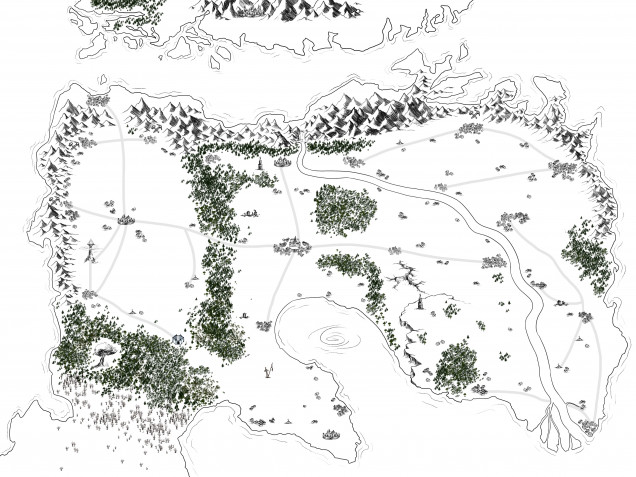
Map of Xi
Xi is the name of the continent in which the main story of Deneb is set. The map is still a work in progress but wanted to share what we have so far.
This version is unlabelled, just because of how the process is working from a graphics design point of view, but hopefully can update with final labelled version soon.
To answer @oriskany’s question from the comments, here is the roughly labelled version with a scale indicator included


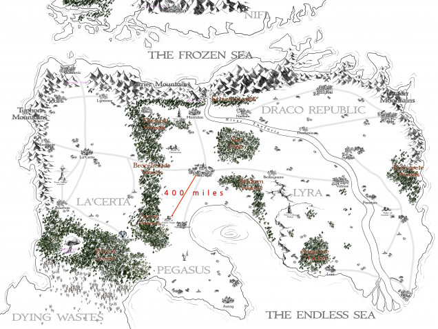






Epic map. Approximately what is the scale? I like how the forests, river, and mountains divide the continent (?) into different zones. I presume these zones would be different areas of climate?
@oriskany I’ve added a second version to the post with a scale indicator and the rough pass on the labelling. Yes this is basically main continent where the narrative is focussed (well and a bit of the Northern polar cap of Nifl). In terms of climate very roughly speaking the east is dry, the west is wet, the north is cold and the south is warm. There are a bunch of complications within that though, as you might imagine! La’ Certa enjoys a generally temperate climate, water that evaporates from the western sea and breaks on the Typhon mountains gives… Read more »
Awesome! I like the dermatological realism of the mountains causing ocean clouds to drop moisture along the coasts, much like California! And the scale helps a lot. When the map is finished, you might want to just crop small sections out for individual write-ups of regions for more setting, history, and culture information (sounds like you have a lot) – this would allow quick publication of many more project entries! 😀
Nice idea! That might be the perfect way to do it.